Van Keulen Maps
Originating from the archive of the Van Keulen Company
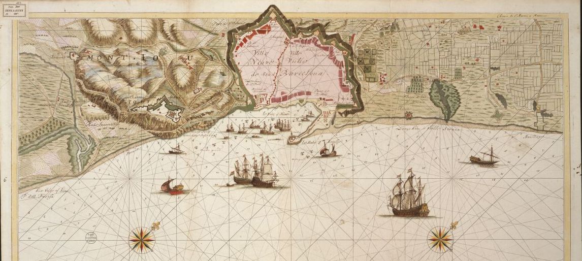
COLLBN 003-04-025
Originating from the archive of the Van Keulen Company
Collection of 334 hand-drawn charts on paper with pre-printed compass lines, covering the coasts of the Atlantic Ocean, Europe, the Mediterranean, West-Africa, the Americas and the Pacific, dating from the first half of the eighteenth century (1704-1755). The charts belonged to the company archive of the Van Keulen publishing house, that existed in Amsterdam from 1680 to 1885, with the addition of some charts from the collection of Bodel Nijenhuis and later acquisitions.
In the early eighteenth century, the Van Keulen’s started to produce manuscript maps for the market. The Van Keulen firm sold hand-drawn charts, produced on sheets of paper bearing pre-printed compass lines and borders. In general, there is too little resemblance between the contents of these manuscript charts and the printed nautical charts to suggest that the former served as models for the latter. Most manuscript charts are drawn on a relatively large scale and represent smaller sections of coast than their printed counterparts. They should therefore be regarded as supplements to the printed charts, produced specifically to aid coastal navigation. Manuscript charts thus fulfilled a clearly independent function and were a unique by-product of the Van Keulen’s workshop (De Vries, 2005, p. 91). Up to now, almost 800 manuscript charts of Van Keulen are traced. The largest set of these charts are kept at Leiden University.


